| |
|
|
Rookhope Interactive Map
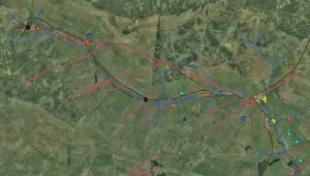
So much of the layout of a mining complex is dictated by topography. This page provide and overview of the landscape around Old
Rookhope Ore Hearth. The image provided on the left is only a preview, you can use the link below to open the
interactive map.
The basemap is a vertical aerial photograph of the area - you can see the watercourse running through the burn from the upper
left to the lower right of the image. Other 'layers' of data include geology, water courses, settlements and rail links.
Layers can be switched on and off using the key to the right of the map, allowing you to create various customised views.
In addition to visibility controls, the control panel also contains 'enlarge' icon which will display a larger image of each layer. This
map can be clicked to learn more about a specific site.
Launch
the Interactive Map in a new window.
|
|